
The Urubamba River of Machu Picchu
The name of the Urubamba River comes from Quechua Urupampa which means “spider plateau”. He was known in the time of the Incas as Willkamayu and was sacred to them. It is one of the main Peruvian rivers and is part of the Amazon basin. By tradition, the Urubamba River is divided in two by the Ponto de Mainique, a small cannon that is dangerous to navigate and has a somewhat sinister reputation.
Features of the Urubamba River
The river on the south side of the pongo is known as the “high Urubamba”, born in the Vilcanota knot, and was known as Wilcamayu (Sacred River) by the Incas; while the north side of the Ponto de Mainique flows into the Ucayali River and is known as the “under Urubamba”, travel much of the department of Cusco with the name of the Vilcanota River, but entering the city of Urubamba, receives the Name of Urubamba River. This river runs through the entire Sacred Valley of the Incas, on its way it passes at the foot of the mountain where Machu Picchu is located, but first passes through Ollantaytambo. After this, it gives life to one of the most fruitful valleys of the province of the Convention in the city known as
Rio Alto Urubamba
The south side of the river before the I put of Mainique, receives the name of High Urubamba.
The Urubamba River in the South Valley of Cusco
His tour of the northeast of the department of Cusco takes him through the Archaeological Complex of Raqchi, where the famous Temple of the God Wiracocha (Creator of the universe according to the Incas) is located; It runs through the South Valley through the town of Andahuaylillas, where the so-called Sistine Chapel of America is located 36 km from the city of Cusco.
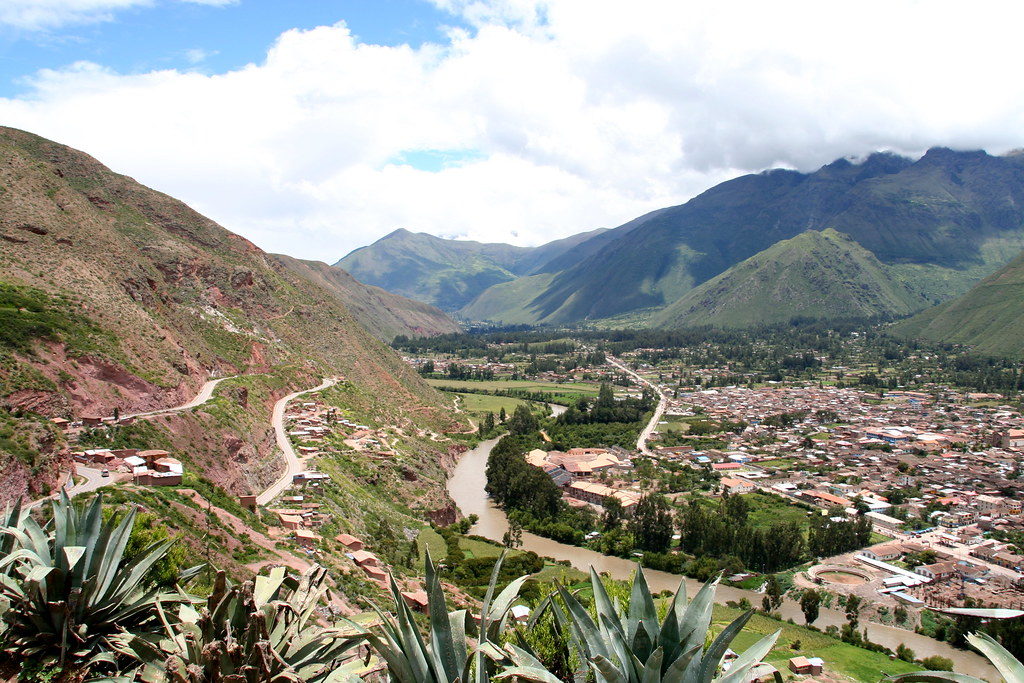
The Urubamba River in the Sacred Valley of the Incas
After passing through this city, the river continues its journey through the Sacred Valley, where it passes through one of the most beautiful villages in the valley and where amazing Inca ruins can be found; it is about the ancient Inca city and the colonial town of Pisac, from where you could monitor the entrance to the Sacred Valley of the Incas and the passage to cities like Urubamba, from which it receives the name, Ollantaytambo and Machu Picchu.
The Urubamba River in Urubamba
Urubamba is the province that produces the largest white corn in the world and where the Vilcanota River changes its name to Urubamba; at the height of this city the river becomes more abundant and turbulent, allowing you to practice level III rafting, along 110 kilometers and with a flow of 600 m3 / s, after enriching this land for the production of corn, the Rio continues its descent to the town of Ollantaytambo, where you will have to board the train to Machu Picchu, or from the incredible Inca Trail to Machu Picchu begins.
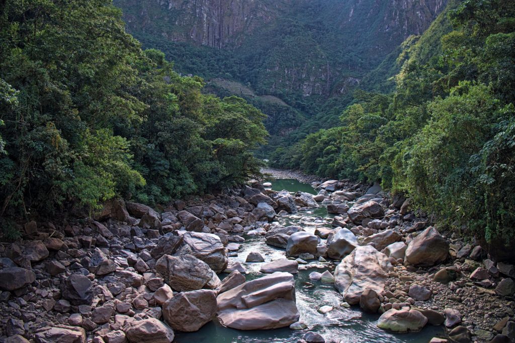
The Urubamba River in Machu Picchu
The Urubamba River surrounds the mountains where the Inca city of Machu Picchu is built and runs through the valley from the city of Ollantaytambo to the town of Aguas Calientes at the foot of the mountain where Machu Picchu is built; Trains to Machu Picchu travel along the banks of the Urubamba River to the Inca (city) llacta. The river surrounds the Huayna Picchu mountain in a circular way, giving rise to an enigmatic and unique landscape, which has inspired thousands of people.
Lower Urubamba River
After passing through Machu Picchu, he continues his tour of the province of La Convencion, where he enters the mainique station and from where he is known as “under Urubamba”; it enters the Amazon rainforest, joins the Hoya del Amazonas, on the Ucayali and Marañón River, to flow into the Atlantic Ocean.
Rafting on the Urubamba River
The Urubamba River offers one of the best possibilities for rafting. The descent of rivers in the Urubamba, is one of the best experiences that can be obtained in the Sacred Valley of the Incas. The Urubamba River normally offers rafting of levels I, II and III, however making your visit to Cusco in rainy weather offers you the opportunity to practice rafting of levels IV and V. The river’s flow levels cause the boats to slide at great speeds; levels from III are considered risk. The Urubamba Valley has a mild climate and the season is year-round. The navigable part of the Urubamba River embraces about 2 km that descend from 2,700 m.a.s.l.
Inca findings on the Urubamba River
Only a few years ago an Inca altar was found buried among rocks of the Urubamba River, it was found at the height of the town of Ollantaytambo; He was found by conservatives while cleaning the riverbanks. This Inca piece is finely carved and only 35% of the entire lithic body can be seen. It is 2.50 meters long by 1 meter wide and weighs about 20 tons. It is one of the best samples of the Incas’ devotion for water, and for this river, sacred to them. The Inca relic will be cleaned, stabilized and then transferred to one of these places: the Plaza de Armas de Ollantaytambo or within its archaeological park.
Flora and fauna of the Urubamba River
Nowadays the places where the Urubamba River passes through has become one of the best places for bird watching in the Cusco region and in Machu Picchu. There are more than 400 species of birds that inhabit the National Park of Machu Picchu. As you enter the valley, the amount of plants and animals will increase; Several of them are species that you cannot see anywhere else in the world. The Historic and Natural Sanctuary of Machu Picchu is home to endangered species, such as the spectacled bear and the cock of the rocks; and a host of insects, butterflies, many unique plants, among which you will find around 500 varieties of orchids.
You also like


Person

Reserva Ahora y Paga
Reservation support
-
Whatsapp
+51 993 492 979
-
Correo electrónico
reservas@machupicchunice.com
© 2024 Machu Picchu Nice / All Rights Reserved By Servico Infrmatico R & M